Sunday 3 November 2019

Return to Sonoma

Earlier this year I was part of a bid led by Lisa Bentley, from Sonoma State University, to explore new methods to estimate fuel loads and fire impacts in forest plots in Northern California. Lisa's bid for CALFire funding was successful (yay!) and as part of it, we are helping Lisa's team deploy TLS in these plots to see how well it can be used to estimate standing fuel, deadwood, brash etc. by looking at plots that were affected in the fires of 2016. The aim is to see how new tech (lidar, drones, mobile phones etc) might augment or improve existing fire risk assessments. 

The urgency of this was brought home very starkly by the huge fires that broke out right in the area we were working, and much more widely, and are still burning as I write this at the start of November 2019. The Kincade Fire in particular has burned right through the Pepperwood Preserve, as well as causing mass evacuation, rolling power blackouts etc. It's hard to imagine how life must feel for people living in close proximity, knowing that a period of dry weather followed by Santa Ana winds, and a spark can lead to this. Lisa and her kids were evacuated late October - all safely back now thankfully. But the conditions leading to these kinds of fires are seemingly only going to get worse i.e. prolonged drought periods followed by high winds.

Phil and I flew out in late September, and met up with Lisa and her team at Pepperwood. Pepperwood itself is an amazing 3200 acre site, in the Mayacamas Mountains between Sonoma and Napa counties, and is home to the non-profit Dwight Centre for Conservation Science, which carries out all kinds of public outreach activities as well as facilitating cutting-edge science.

The field team in one of the plots affected by the 2016 fires - all these trees (pines) are dead from the previous fires and so at some point will fall, becoming fuel for future fires.
The pine plot shown above, but looking up to the crown. These are large trees (probably > 40m) and so you can get an idea of how severe the fires were in 2016.
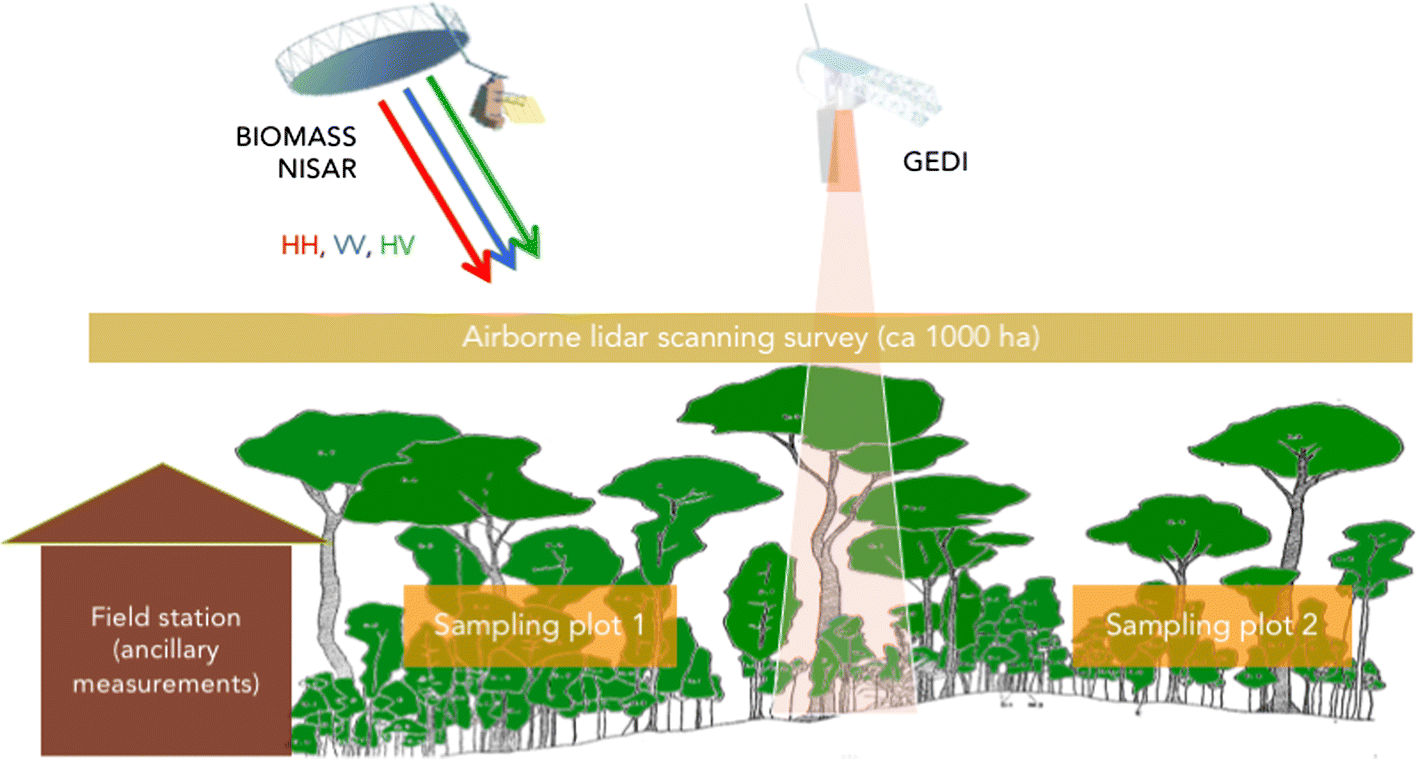
The TLS scans were being collected in about 25 plots spread across Pepperwood, each 50 x 50 m i.e. 0.25 ha. The sites were a mix of deciduous (oak and other), evergreen (pine), and more savanna-like plots in the rolling hills. 

Panorama of an early morning walk to a lower stature oak-dominated plot, with mist lying over Santa Rosa in the distance.  The site is a working ranch so cattle grazing plays a strong role in the nature of the plots.

One of the plots reached from the walk above, showing the steep terrain in places down to creek beds as well as the noticeable impact of fire.

Working in the Dwight house, or accommodation for most of the time we were there. Great views from the balcony!
We were lucky to be able to stay for much of our trip in accommodation actually on the Preserve, in the Bechtel House, which adjoins the Dwight research station. The view from the lounge out over the hills was pretty spectacular, and the sunsets even more so!

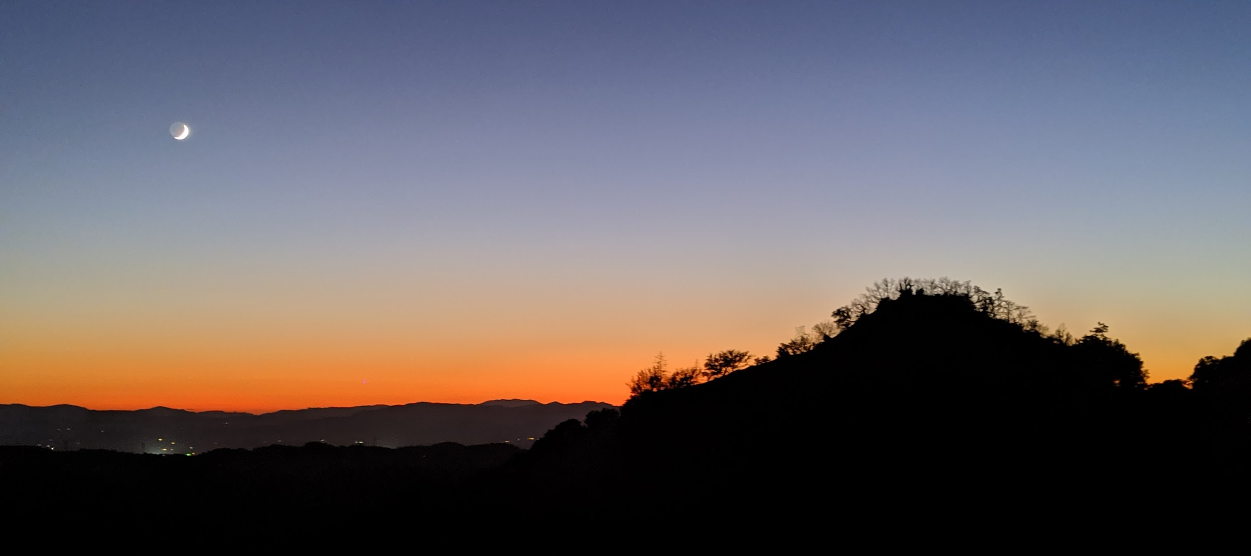
Sunset / moonrise looking West from the porch of the Bechtel House, with Hairy Mountain in the foreground.
The weather was sunny but cool - having seen forecasts of 30+ degrees (C that is) Phil and I were maybe a little underprepared for overnight temperatures down in the low single figures and frost on the windows. Phil and I were reduced to sharing a hat.


Lisa's team very quickly picked up the challenge of using the TLS and the software, and were soon zipping through the plots, processing data and starting to think how to use them (them, Paris). A key part of this is likely to be how to provide baseline estimates of fuel loads that can be compared to used to update, the more rapid but more qualitative line transect estimates of fuel that form the basis of routine assessment currently. The challenge is to find ways to improve on those estimates, using approaches that are rapid and easy-to-deploy if possible. Lisa's team also used our ZEB-REVO to scan the ground layer - can those data be used to estimate ground fuel and even duff for example? Meanwhile, Matt Clark was collecting UAV spectral data over the same sites, in order to explore the possibilities for using eg SfM to estimate fuel loads over wider areas. 
Lisa, hard at work, controlling the Riegl with her cellphone (in left hand) - master of all she surveys.
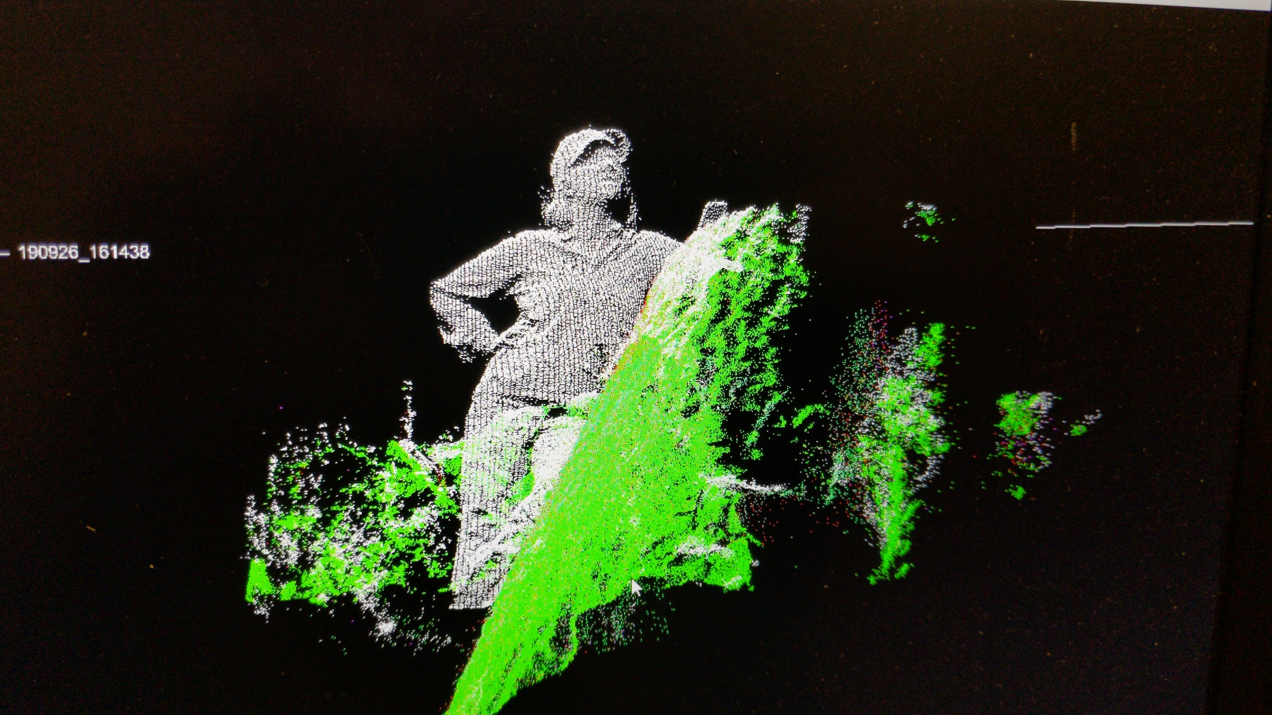
Phil noticed this cool oak growing out of a large rock so we scanned it will Paris and Sean were climbing it. Phil then generated a nifty Sketchfab model of it!
Rock-grown oak.

We'll be back with Lisa's team next year, to carry out measurements at other sites, as well as potentially back to some of the existing plots if they've been affected by fire again in the current season. 

Tuesday 30 July 2019

Book alert!

The work of our group features in several chapters in a new book describing the new opportunities and challenges for measuring the biomass of forests from space. The book, "Forest properties and carbon cycle studies from Earth Observations", edited by Klaus Scipal, Anny Cazenave, Teodolina Lopez (ISSN: 0169-3298 (Print) 1573-0956 (Online)) is a Special Issue of Surveys in Geophysics (vol 40, issue 4) and is the outcome of a Workshop on “Space-Based Measurement of Forest Properties for Carbon Cycle Research” held at the International Space Science Institute (ISSI) in Bern, Switzerland, from 6 to 9 November 2017.

The ISSI workshop pulled together experts from various fields and space agencies to discuss key science questions, community needs and new technologies for estimating forest biomass from space. The book summarises the state-of-the-art in space-based observations of biomass including new space-based radar and lidar (laser) instruments being launched now and over the coming few years. In addition, there is an exploration of the various challenges to making best use of these new observations, both scientifically and in terms of policy aimed at reducing emissions due to deforestation and degradation.

I led a chapter on terrestrial laser scanning as a key tool for improved calibration and validation (cal/val) of satellite observations of biomass.
Figure from Disney et al. (2019): TLS of 3 contrasting forest types, with each individual tree coloured separately. Top to bottom: Wytham Woods, UK; Caxiuanã, Brazil; Lopé, Gabon.
I also contributed to a chapter by Laura Duncanson on new cal/val protocols for biomass, and to a chapter by Jerome Chave on the importance of more and better ground data to underpin these space missions.

Figure from Chave et al. (2019) illustrating the Super Site concept for ground-based data collection for cal/val of new EO missions providing biomass estimates.
The book is aimed at a general audience of those interested in carbon cycle science, but will be of particular interest to people at the interface of science and policy. The success of initiatives such as the UN REDD+ program to reduce deforestation and degradation will rely on the observations and methods described in the book.

Wednesday 17 April 2019

Tallest trees, new publications and Hardy Ash revisited ...

We've been involved in some exciting work measuring what is likely to be the tallest tree ever measured in the tropics, in the rainforests of Sabah, Malaysian Borneo. The tree, nicknamed “Menara” or Malay for “tower”, may also be the tallest angiosperm (flowering plant) in the world, a title currently held by "Centurion", a Eucalyptus regnansin Tasmania, Australia, measured at 99.67 m in 2016. Menara is a Shorea faguetiana (common name Yellow Meranti), of the Dipterocarpaceae family that dominates the humid lowland rainforests of SE Asia, and is 100.8 m from top to ground. It was originally identified in airborne lidar by a team from Nottingham University and partners including the South East Asia Rainforest Research Partnership) in 2014. The tree was then located on the ground by a Malaysian team and climbed and measured by Unding Jami. Phil then helped train local researchers to operate our laser scanner, in conjunction with a team from Oxford University led by Allie Shenkin. 
The view from the bottom of the tallest tropical tree in the world
'Menara', picture by Unding Jami. See https://www.eci.ox.ac.uk/news/2019/0408.html.
Allie also produced some amazing visualisations of the tree using the TLS and drone data. More pictures soon when the paper on this comes out.

We've been busy at the start of spring preparing for new campaigns in Peru, Gabon, the UK and in Germany. This means piecing together the jigsaw of travel plans and logistics, which Andy and Phil are leading. The German work will be in support of an ESA campaign in Kermeter, Germany later in the year, where airborne P-band radar and lidar data are being collected as part the lead up to the BIOMASS mission in 2021.

Matheus has defended his PhD, and passed with minor corrections - of course! Examined by Prof. Mark Danson from Salford, and Prof. Peter Muller from MSSL here at UCL, they were both impressed by his work. Matheus has already published 5 papers before submitting his PhD, including the most recent one in MEE summarising his leaf-wood separation work. This is a really excellent paper, providing a significant advance in what we're able to do with TLS data and opening up lots of new areas of exploring tree structure and function.

We've had a few other new papers out since the last post, perhaps most notably one of a collection by various authors on forest biomass, in an edited volume that is coming out in Surveys in Geophysics: Forest Biomass and Structure from Space. This book arises out of the ISSI-organised meeting in Bern in late 2017 and will be an excellent resource, as it will contain a really useful summary of the state-of-the-art in the field. Our first contribution is the chapter "Innovations in ground and airborne technologies as reference and for training and validation: Terrestrial Laser Scanning (TLS)".

Figure 1 from Disney et al. (2019) showing various examples of TLS point clouds.
Meanwhile I've been out and about doing various talks, including an invitation to speak as part of the lunch-time lecture series to staff at Kew Gardens (including a live feed to the Kew Millenium Seedbank at Wakehurst Place, Sussex). This was a real honour and slightly nerve-wracking as talking about trees to the Kew experts seems a little like teaching your grandmother to suck eggs as the expression goes. I also recently appeared via video link to speak as part of the Climate Conversations lecture series at Lawrence Berkeley National Laboratory, SF - another fun and interesting experience. Last but by no means least I was invited to my daughter's school in Hackney to talk about their current topics, trees and the Amazon - it's always fun to try out new material on a tough crowd - if it's not snappy they lose interest pretty quickly.

News from the GEDI mission - things are looking very good so far and the first release of data is pretty impressive. Glad to see they're continuing to rinse the Star Wars link for all it's worth :-) Can't wait to start seeing some of these data over our sites - this is going to be fascinating.


GEDI returns over US, from: https://earthobservatory.nasa.gov/images/144818/return-of-the-gedis-first-data 

Lastly, Phil went back to scan the Hardy Ash in Old Pancras Church yard following some remedial tree pruning work. See the details here, but also Phil's Sketchfab model below.


Monday 25 February 2019

Vegetable monsters

We've been keeping an eye out for unusual urban trees we can potentially scan. This is partly to build up a collection of the 3D tree structures in more extreme environments, extreme in this case being the level of pressure and management they are likely to have undergone. More generally, this is part of understanding the wider issue of urban tree cover, and how and why some trees survive and thrive. Mostly this is down to management and preservation but of course that reflects what has been planted in the first place and why.

Phil was alerted to these amazing redwoods on Canons Drive, Stanmore via twitter - the go-to research tool for urban forests, obvs! This private drive has an avenue of sequoias (or Wellingtonia - see below for some history of that name) planted by the Duke of Chandos. How we ended up with sequoias in the UK is an interesting bit of history as well; clearly the Duke of Chandos wanted to build an estate that was right on the cutting edge of the latest horticultural fad.

Phil, KC and I spent a morning admiring the trees and scanning up the drive. The tallest is around 33 m and you can see from the figure below the range of shapes. This is another great illustration of the variety of 3D structure we see from particular species in the same climate, but under different other external pressures.

Extracted point clouds of the Canons Drive sequoias (P. Wilkes)

Phil has also produced a rather nice flythrough down the drive based on these data.
Canon St Giant redwoods from Phil Wilkes on Vimeo.